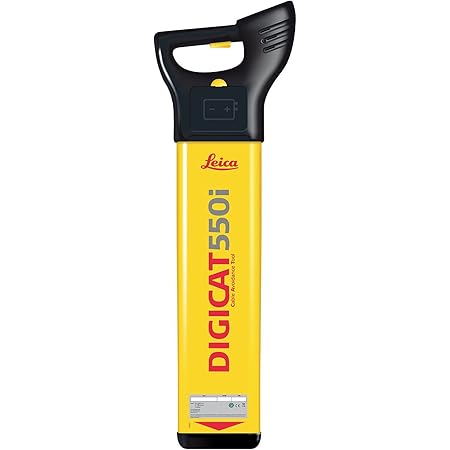
The invisible network of underground utilities – water mains, gas lines, electrical conduits, and telecommunications cables – is the lifeblood of modern infrastructure. Yet, their hidden nature presents a significant challenge for construction, excavation, and maintenance professionals. Accidental strikes can lead to catastrophic consequences, including service disruptions, costly repairs, severe injuries, and even fatalities. This underscores the paramount importance of accurate and reliable utility line locators. Choosing the right locator is not a decision to be taken lightly. It requires a deep understanding of the features that differentiate superior instruments from their less capable counterparts. This article delves into the critical features to prioritize when selecting a utility line locator, equipping you with the knowledge to make an informed and safe investment.
The Foundation of Accuracy: Understanding Locating Technologies
Before dissecting specific features, it’s crucial to grasp the underlying technologies that power utility line locators. Most modern locators employ electromagnetic principles. They work by either inducing a signal onto the target utility or by detecting existing electromagnetic fields emanating from energized lines. Understanding these principles helps in appreciating the nuances of different locator functionalities.
Active Locating: The Inductive Approach
Active locating involves introducing a specific frequency signal from a transmitter onto a conductive utility. The locator’s receiver then detects this signal, allowing the operator to trace the line. This method is highly effective for non-energized conductive lines but requires direct or indirect connection to the utility.
Passive Locating: Harnessing Existing Energy
Passive locating relies on detecting electromagnetic fields naturally generated by energized utilities. This is particularly useful for identifying live power lines or telecommunication cables without needing to connect a transmitter. However, accuracy can be more challenging in complex environments with multiple energized sources.
Core Features for Unwavering Precision
When evaluating utility line locators, several core features stand out as non-negotiable for achieving accurate and consistent results. These features directly impact the locator’s performance in real-world scenarios.
Signal Strength and Quality Indicators
The ability of a locator to clearly indicate signal strength is fundamental. A strong, consistent signal is indicative of a direct connection to the target utility. Conversely, weak or fluctuating signals might suggest indirect detection, potential interference, or a less conductive target. Look for locators that provide:
- Visual Indicators: Bar graphs, numerical readouts, or a series of lights that visually represent signal strength.
- Auditory Feedback: Variable pitch or volume that changes with signal strength, providing an immediate auditory cue.
- Sensitivity Controls: The ability to adjust the receiver’s sensitivity to fine-tune signal detection and filter out background noise.
Example: A contractor working on a densely populated urban street will benefit immensely from a locator that can clearly distinguish the signal of the target water main from the myriad of other underground signals present. Advanced sensitivity controls allow them to isolate the desired signal more effectively.
Depth Measurement Capabilities
Knowing the depth of a utility is as critical as knowing its horizontal position. Accidental damage often occurs when excavators misjudge depth. Top-tier locators offer precise depth measurement functionalities, often relying on the same signal being transmitted or detected. Key aspects to consider include:
- Accuracy Specifications: Reputable manufacturers will provide clear accuracy ratings for their depth measurements under various conditions.
- Automatic Depth Calculation: Many modern locators automatically calculate depth based on signal characteristics, simplifying the process for the operator.
- Confirmation Mechanisms: Some advanced locators provide multiple readings or a confirmation mode to ensure the depth measurement is reliable.
Statistic: According to the U.S. Common Ground Alliance’s 2023 DIRT Report, backhoe digging was responsible for 35% of all damages, highlighting the importance of accurate depth information for excavators.
Frequency Versatility

Different utilities and locating scenarios benefit from different frequencies. A versatile locator will offer a range of frequencies to optimize signal transmission and reception. This adaptability is crucial for overcoming challenges such as varying soil conditions, utility materials, and the presence of other signals.
- Multiple Active Frequencies: The ability to switch between low frequencies (for deeper, longer-range locating) and high frequencies (for better resolution on shallow utilities).
- Passive Frequencies: Built-in capabilities to detect common power line frequencies (e.g., 50/60 Hz) and radio frequencies.
- Smart Frequency Selection: Some advanced locators can automatically identify and suggest optimal frequencies based on the environment.
Directional Information
Beyond simply indicating the presence of a line, a good locator should provide clear directional guidance. This helps the operator quickly and efficiently trace the path of the utility, especially in complex networks or when dealing with bends and junctions.
- “Left/Right” Indicators: Visual cues that guide the operator in the correct direction to follow the line.
- Center-Line Indication: A clear indicator when the receiver is directly over the center of the utility.
- 3D Guidance: Some high-end models offer three-dimensional directional guidance, which can be invaluable in challenging terrain.
Enhancing Efficiency and Usability
Beyond the core locating capabilities, several features contribute to a locator’s overall efficiency, user-friendliness, and longevity in demanding field environments.
Ergonomics and Portability

Field professionals spend long hours using their locators. An ergonomic design that is lightweight and easy to handle reduces operator fatigue and improves productivity. Consider:
- Lightweight Construction: Reducing the overall weight without compromising durability.
- Comfortable Grip: Designed for extended use.
- Adjustable Handle/Shaft: Allowing operators of different heights to use the equipment comfortably.
- Compact Storage: Easy to transport and store in a vehicle.
Durability and Environmental Resistance
Utility locating often takes place in harsh outdoor conditions. The locator must be built to withstand dust, dirt, moisture, and physical impacts. Look for:
- IP Rating: A high Ingress Protection (IP) rating indicates good resistance to dust and water.
- Robust Casing: Made from durable materials like reinforced plastics or metal alloys.
- Sealed Components: Protecting sensitive electronics from environmental ingress.
- Operating Temperature Range: Ensure the locator can function reliably in the expected temperature extremes of your work environment.
Case Study: A utility company operating in a coastal region with high humidity and frequent rainfall invested in locators with high IP ratings. This significantly reduced equipment downtime and repair costs compared to their previous, less robust models.
Battery Life and Power Management

A dead battery in the field can bring operations to a halt. Extended battery life and efficient power management are essential. Consider:
- Long Operating Time: Look for locators that can operate for a full workday or longer on a single charge.
- Rechargeable Battery Options: Availability of high-capacity rechargeable batteries.
- Interchangeable Batteries: The option to quickly swap out depleted batteries for fresh ones.
- Low Battery Indicators: Clear warnings when battery levels are getting low.
Data Logging and GPS Integration
For projects requiring meticulous record-keeping or mapping, data logging and GPS integration are invaluable features. These capabilities enhance post-project analysis and future planning.
- Onboard Data Storage: The ability to store locating data, including position, depth, and time.
- GPS Tagging: Automatically recording the geographical coordinates of located utilities.
- Data Export Options: The ability to easily export logged data in standard formats (e.g., CSV, KML) for use in GIS software.
Benefit: A city’s public works department uses locators with GPS integration to create an accurate digital map of their underground infrastructure. This data is crucial for future planning, preventing accidental damage during new construction, and responding effectively to utility emergencies.
Advanced Features for Specialized Needs
While the core features are crucial for all users, certain advanced functionalities cater to specific and demanding applications.
Ground Penetrating Radar (GPR) Integration
For locating non-conductive utilities (like plastic pipes) or providing a more comprehensive subsurface view, the integration of GPR technology can be a game-changer. GPR emits radio waves into the ground and analyzes the reflected signals to create an image of the subsurface. While often a separate system, some advanced locators offer integrated GPR capabilities or seamless compatibility.
Multi-Frequency Transmission and Reception

Beyond simply having multiple frequencies, some locators allow for simultaneous transmission and reception of multiple frequencies. This can significantly improve accuracy in complex environments with multiple utilities and reduce the time required for tracing.
Smart Connectivity and Cloud Integration
The latest advancements include locators with Wi-Fi or Bluetooth connectivity, allowing for real-time data synchronization with cloud platforms. This facilitates remote monitoring, firmware updates, and collaborative data management for larger organizations.
Investing in Safety and Efficiency
Selecting the right utility line locator is an investment in safety, efficiency, and the long-term integrity of infrastructure projects. By prioritizing features such as robust signal indicators, accurate depth measurement, frequency versatility, and clear directional guidance, professionals can significantly mitigate the risks associated with underground utility work. Furthermore, considering ergonomic design, durability, extended battery life, and advanced features like data logging and GPS integration will ensure the chosen locator not only performs exceptionally but also integrates seamlessly into the workflow, ultimately contributing to a safer and more productive working environment. A thorough evaluation of these key features will empower you to unearth the perfect tool for your utility locating needs.